Fig. 5
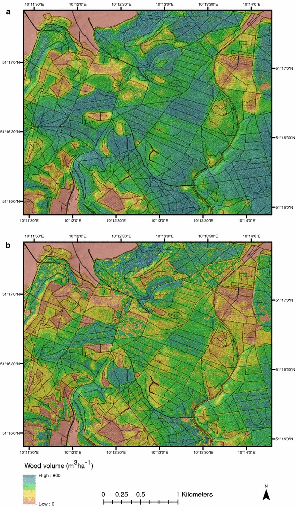
Landscape scale extrapolation of wood volume from the 1 ha model (a) and the 0.05 ha model (b). Black lines indicated forest management unit boundaries
Landscape scale extrapolation of wood volume from the 1 ha model (a) and the 0.05 ha model (b). Black lines indicated forest management unit boundaries